The order of battle was as follows:-
1. Fly to the area, survey and choose a lake and land on it.
2. Use AFCAD to create a new airport there with one runway aligned on the lake as required. The runway to be INITIALLY 6000 feet by 500 feet Concrete.
3. Slew off the end of the runway to the shore where scenery is to be added and continue to a suitable clearing in the trees and using AFCAD add an NDB and a few yards further on a DME.
4. Change the aircraft to a scenery positioning graticule and position it to each corner of the 500 feet wide runway and note the four lat and longs of those corners.
5. Using XML code add a Dolphin with a strobe light on the top to each of those locations.
6. Use ez-scenery to make some pontoons off the beach and then position the aircraft where you would like each pontoon berth. Switch to AFCAD with FS9 padlocked to it and plonk a "Dock" parking at each of those positions.
7. In AFCAD make the taxyways from these Docks out to the runway ends ALL taxyways to be the green apron connector type and with Zero width and NO markings or lights...If you want a "No Pushback" setup, then make a separate TAXY OUT route on one side of the runway and a TAXY BACK route on the other side of the runway...The difference between the two is that the TAXY OUT goes all the way to the runway extremities where as the TAXY BACK route links to turn off from the runway on the return side only and NOT from the extremities (have about 8 turn off points but well short of the ends). Add a hold short point to each connection with the runway and make its circle actually include the centreline of the runway (NOT just the edge because the runway width is to later be reduced).
8. In Ttools make a basic line for each parking dock like this:-
AC#1,N38DD,1%,4Hr,VFR,01:10:00,01:25:00,010,R,0007,M002,03:10:00,03:25:00,010,R,0007,M002
AC#5,NI7546,1%,4Hr,VFR,01:20:00,01:35:00,010,R,0007,M002,03:20:00,03:35:00,010,R,0007,M002
AC#7,N68010,1%,4Hr,VFR,01:25:00,01:40:00,010,R,0007,M002,03:25:00,03:40:00,010,R,0007,M002
AC#6,N54691,1%,4Hr,VFR,01:30:00,01:45:00,010,R,0007,M002,03:30:00,03:45:00,010,R,0007,M002
AC#2,CFBP103,1%,4Hr,VFR,01:35:00,01:50:00,010,R,0007,M002,03:35:00,03:50:00,010,R,0007,M002
That will suit a 5 dock setup and each floatplane will taxy out, take-off, fly locally for a few minutes, join downwind and land just as the next guy is taking off...notice each line has two sequences as it will not work with one.
9. With the Traffic checked the AFCAD work is now finished and the fuel pump, fuel tank, NDB and DME, cabins, cars etc can be added with ez-scenery.
10. Finally add the fuelling trigger with XML code to the same Lat and Long as your fuel pump or the lat and long of a position in the water near the pump...Here is the code for that:-
<!-- Fuel Pump -->
<SceneryObject lat="40.665795" lon="-81.1911524" alt="1.214F"
altitudeIsAgl="TRUE" pitch="0.00" bank="0.00" heading="190.00"
imageComplexity="NORMAL">
<LibraryObject name="621602d5cb690567aeebe4235533c69b" scale="1.00" />
</SceneryObject>
<SceneryObject
lat="40.6657183"
lon="-81.1910933"
alt="1.214F"
altitudeIsAgl="TRUE"
pitch="0"
bank="0"
heading="190.00"
imageComplexity="NORMAL">
<Trigger
type="REFUEL_REPAIR">
<Fuel type="100"/>
<Vertex biasX="-15" biasZ="-15" />
<Vertex biasX="-15" biasZ="15" />
<Vertex biasX="15" biasZ="15" />
<Vertex biasX="15" biasZ="-15" />
</Trigger>
</SceneryObject>
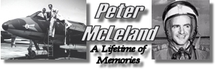
11. I add the wheeling seagulls and other static birds last...The statics with ez-scenery and the wheeling gulls with some code from McLeland Field (I just change the lat and long to the first four decimal places to about the centre of the pontoon and I leave the remaining 3 of four decimal places in the lat and longs as they are, and that gives the same spread to the groups of wheeling gulls as I have at base).
12. Oh yes I forgot to say that when you have finished the AFCAD work, you reduce the runway width to .001 (that is POINT 001), but leave it as concrete...The runway will now be invisible on the surface of the water but will still work for the Traffic. The black RUNWAY line that you placed between the end runway nodes can be set with Zero width but the runway itself in AFCAD > List > Runways > Properties, is not permitted to be Zero.
BTW for a new airport when adding and NDB or AFCAD you are asked for the "REGION"...This id a two letter code and you can find what it should be by opening the nearest airport in AFCAD and copying it from there (List > Navaids > Properties). You should also use the same MAGVAR as the nearest airport.
I hope this is of use to people getting into scenery making...BTW for FS9, ez-scenery sees far more libraries that Instant Scenery.


 but my expertise & available time preclude my doing that.